
Getting To The Region Tyne and Wear is easily reached from all parts of both the United Kingdom and the rest of the world using a variety of means of transport. There are good road links to other parts of the country, although the A1 north of Newcastle is quite a dangerous route so caution should be observed. Newcastle International Airport has flights to most other parts of the United Kingdom, Ireland and selected destinations worldwide while you can travel by ferry from Scandanavia and Amsterdam to the port near North Shields. The rail service between London, Newcastle and Scotland is operated by GNER and is fast and freqeuent, while other services through Newcastle are operated by Virgin Trains and Northern Spirit. National Express also operate coaches from destinations around the country.
Getting Around The Region If you have a car, the road network around Tyne and Wear is pretty good although like most places it gets very congested at peak times. A road map of the area can be found here (File Size 300k). Public Transport in the area is second to none, with prices set pretty favourably compared to other cities. The Metro system serves most places around Newcastle and is soon to be extended to Sunderland while buses everywhere else fill the gaps. Service frequencies obviously vary but within urban areas, you'll not have long to wait. Local buses in Tyne and Wear are generally operated by Stagecoach, Arriva and Go-Ahead with modern vehicles. The Shields Ferry links North and South Shields every thirty minutes, while there are also local rail services between Newcastle, The Metrocentre, Carlisle, Sunderland, Durham, Morpeth and Teeside operated by Northern Spirit.
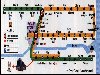
Road Map Of Tyne And Wear (File Size 300k)
This Page Was Last Updated On Friday 12th May 2000 At 0300